 single channel video, 14:12min, HD, 2016/17
watch excerpt
for screening and exhibition rentals contact the Video Data Bank in Chicago
Every country employs specific techniques for disguising its soldiers, every army has developed its own camouflage uniforms. Croatia is one of the few countries in the world that uses a digitized shape of its own territory in its camouflage military design. Why? The question is not meant to be answered by human reason. It does not relate to the perception of human eyes. Night vision cameras, binoculars, heat detectors and drones have their own ways of seeing the world.
Waypoint, Follow, Orbit, Focus, Track, Pan
“Surveillance technology and camouflage have an almost century-old intriguing relationship. As with many developments in military technology, artists have always been critically engaged with its development and appliance, one way or the other.
In 1912, the American painter Abbott Thayer had a strong influence on the genesis of military camouflage, when he introduced an detailed analysis of so-called countershading and disruptive coloration in the feather patterns of particular bird species.
Exactly hundred years later the first commercially available drone was repurposed by Irish artist Nina McGowan and digital rights lawyer and Caroline Campbell to “spy on the spies.” By using a drone to film activities in the offices of Google and Facebook through their upper floor conference room windows, they pointed the gaze back towards the master surveillance architects themselves.
The relationship between this form of concealing and spying is a paradoxical affair that certainly aligns perfectly with all other troubling binaries within 21st century digital culture. From financial markets and economic forces to state legislation and global warfare the machines against machine paradigm in which human interaction is partly or completely removed becomes increasingly prevalent in the world. For instance stock market transactions propose to leave out any form of human involvement due to time delaying concerns. Similarly the pattern-enhancing recognition of surveillance and combat drones react to the so-called multi-scaled camouflage patterns, which -by no surprise – are nowadays computer generated. One could imagine this exchange as a notorious machine learning loop in which one side of the AI enhancement is constantly instructed to sabotage the other.
eteam’s video work “Waypoint, Follow, Orbit, Focus, Track, Pan” challenges the aforementioned relationship between surveillance and camouflage with a very unusual approach.
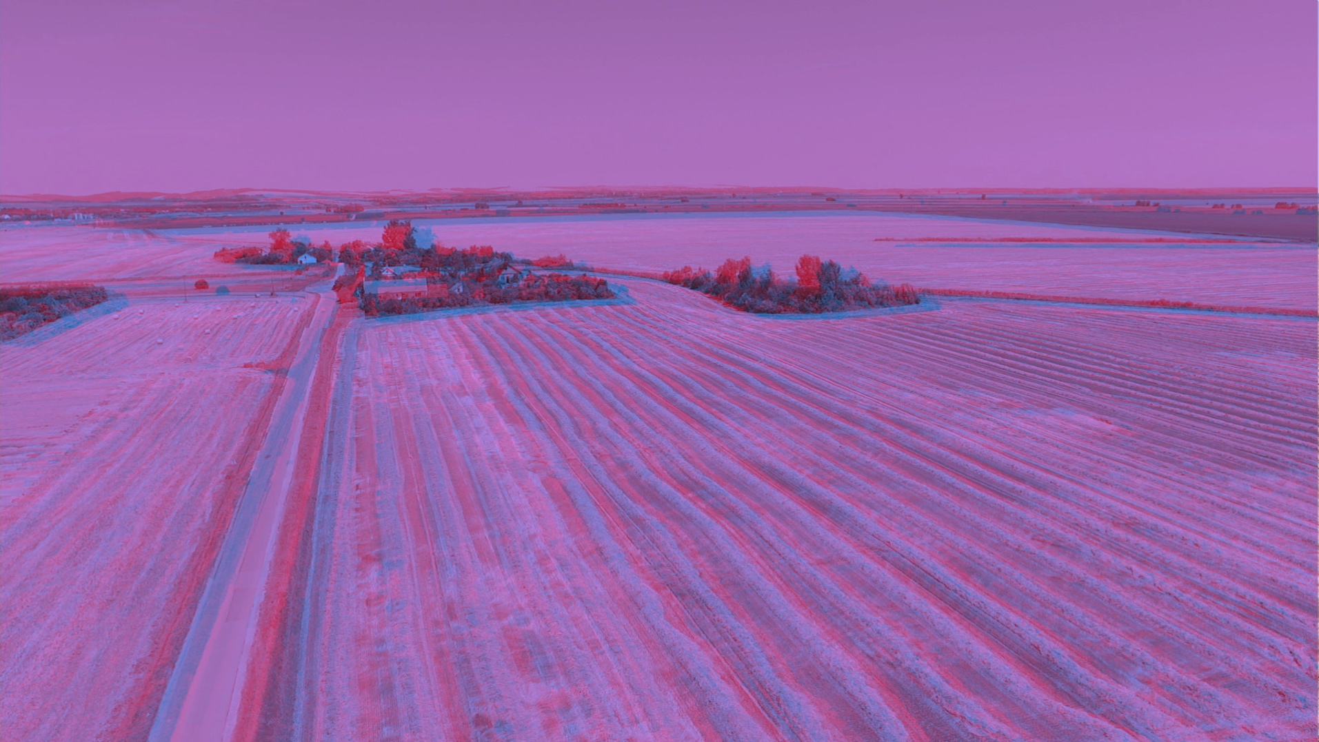
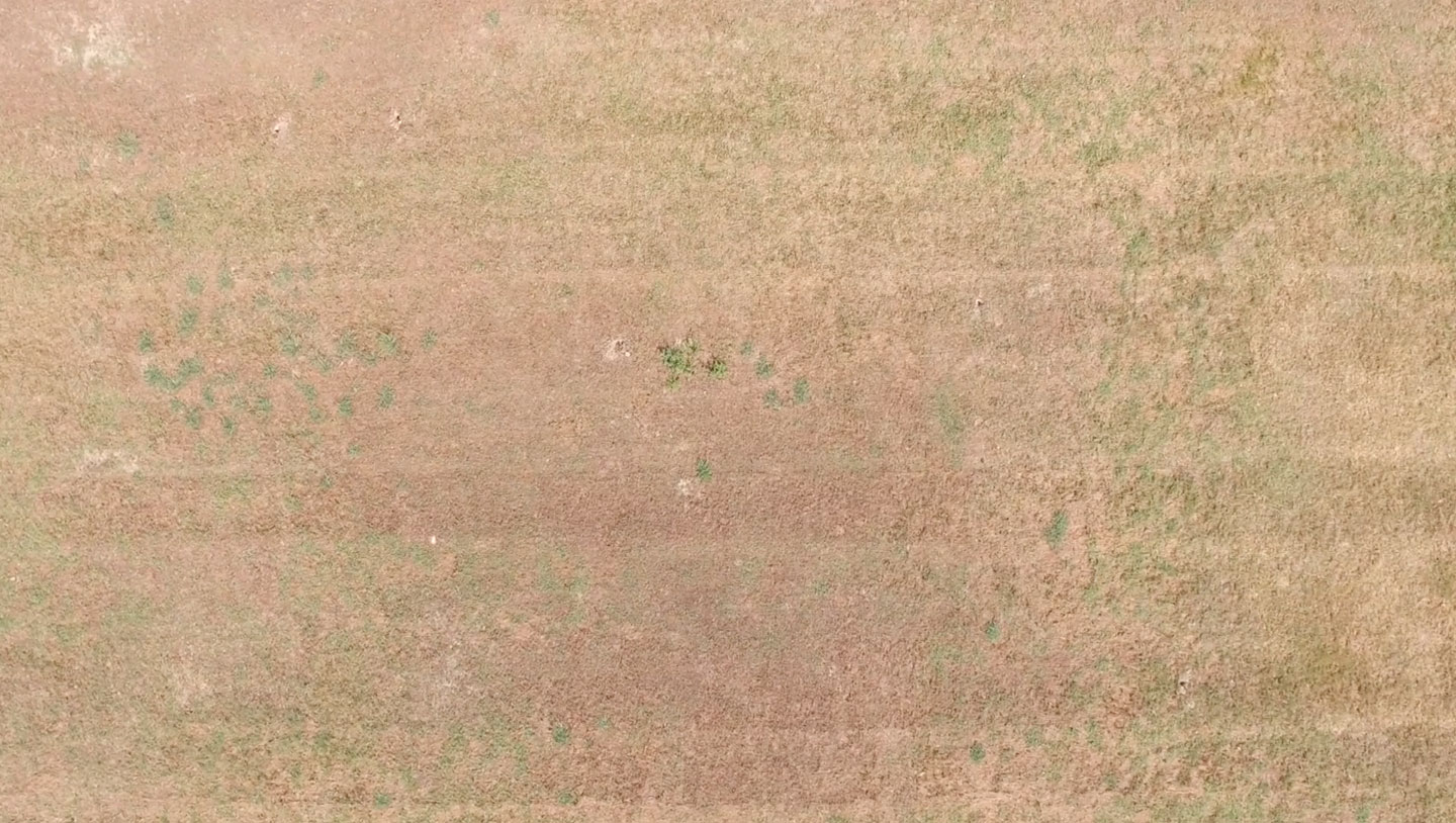
The very first image of the video is already concerned with the troubling question on what a drone is not seeing when pointing to the ground. How much crucial information of a state-of-the-art pattern recognition system is left out when a drone surveils in flat down bird’s eye view. eteam presents a scene that could be imagined as surveilling a camouflage pattern, scaled to landscape size, in which its topography is only revealed over time by the (time-lapsed) trajectory of the sun. The shadows cast from the pixel-blocks begin to grow, revealing each of them as three-dimensional plinths until their long, black shadows cancel out the entire image. A possible reading: Whatever supposed to be camouflaged, nature’s temporal dimension interferes and ultimately scrambles any human, computer-aided strategies of representation.
![]()
Yet the video is not remaining on far distance observation; on the contrary, eteam zooms right in, as there is also a geopolitical aspect – a particular camouflage pattern that caught the artists’ interest. The video was developed as a multi-disciplinary art project in Zagreb where eteam traced an earlier news announcement about the fact that Croatian forces had introduced a new pixelated camouflage design in 2005. It included, as a recurring element, the shape of the Croatian state, crudely pixelated and camouflaged into the camouflage itself.
“Multi-scale” camouflage means that it is designed to work equally effective in far distance as well as in close-up view. However, the insertion of the country’s shape is not only a human interaction into this fully computer-calibrated process, it inserts an odd patriotic gesture into the only space which is supposed to do the opposite – to optically conceal. The military world is otherwise full of symbols, colors and codes to secure immediate state and unit identification in combat, yet the camouflage has now a symbol embedded which collapse two opposite stealth techniques, the one that tries to scramble and the other that hides in plain sight of hyper visibility of repetition.
The lucid visibility of a shape that is recognizable as the Croatian state border could potentially be detected by an ultra high-res pattern recognition system, therefore rendering it completely useless. But eteam is interested to re-examine this camouflage and its modalities when placed into the real world landscape, literally bringing the Croatian uniform with the particular pattern back to the battle grounds of the bloody Croatian Independence war during the breakup of Yugoslavia.
One could assume that nowadays any military camouflage is produced primarily for machine vision and only secondary for human eyes. eteam seems very concerned about the distinction between human and machine vision, now asking further how that digitized camouflaged object, thrown into nature, is seen by electronic eyes?
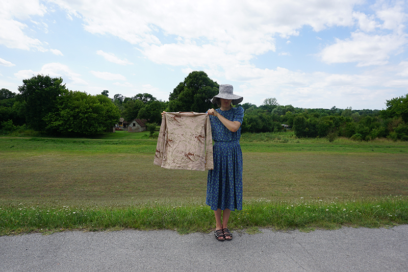
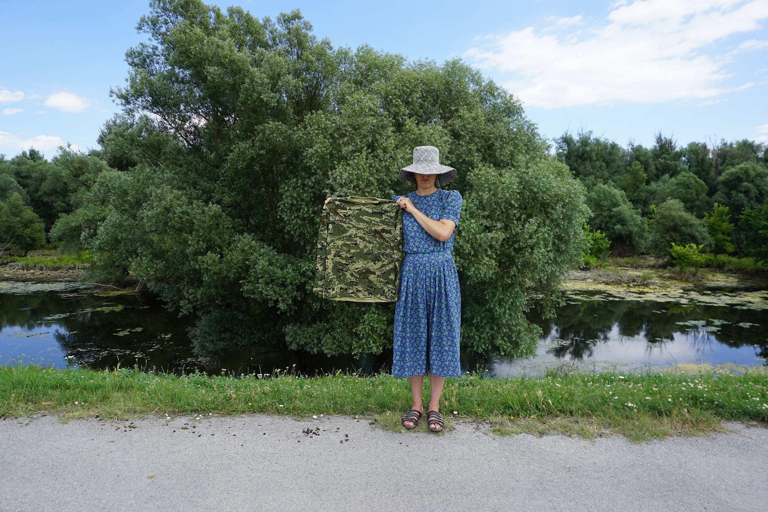
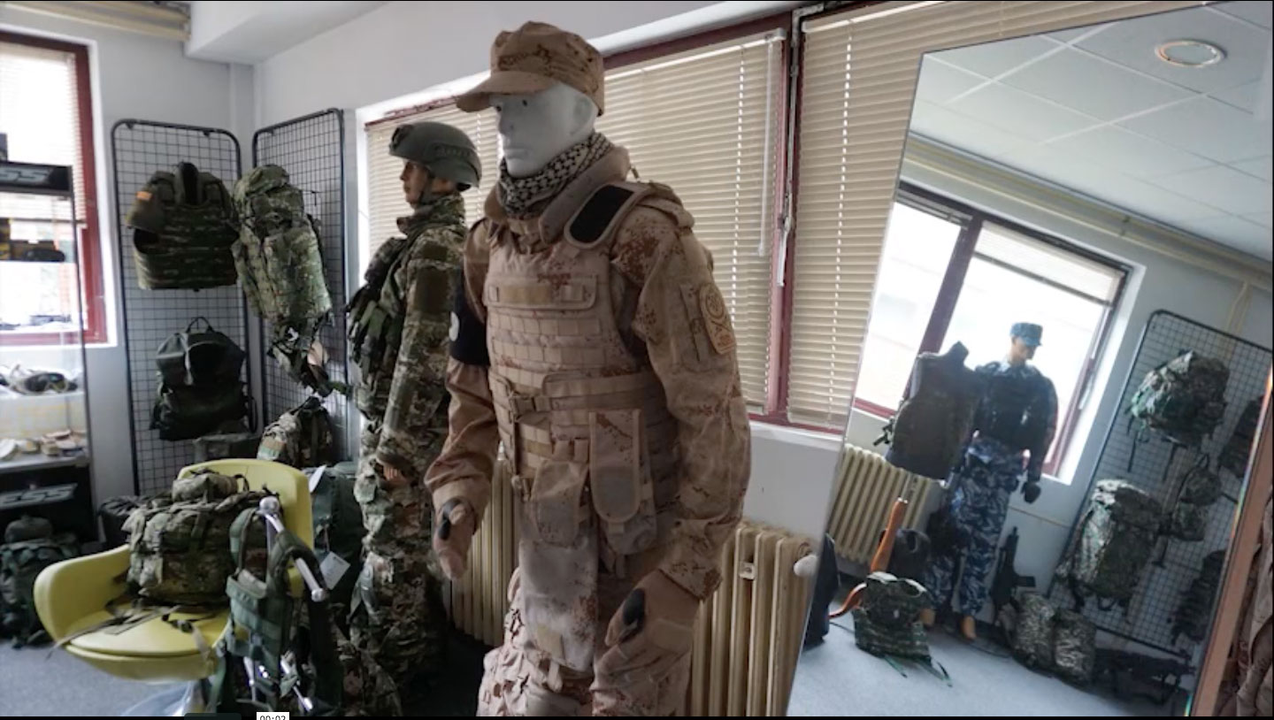
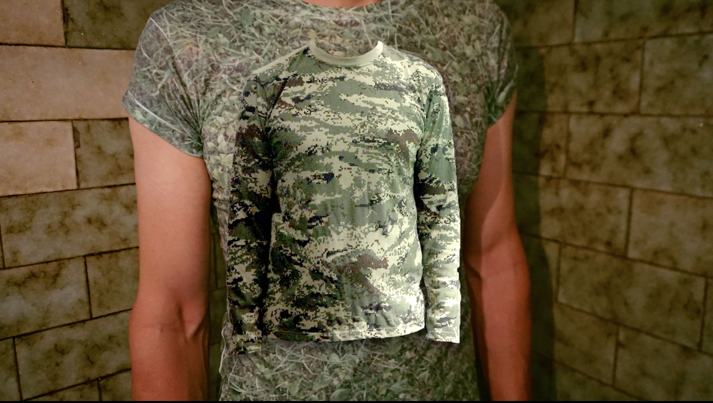
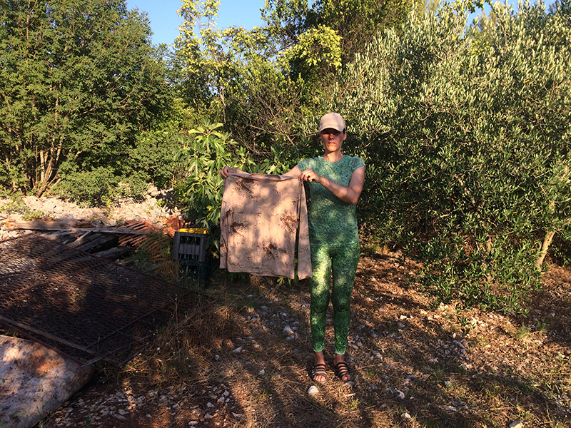
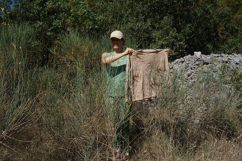
The Croatian army T-shirts are held by eteam into various historic sites, as if it would make a reconnaissance drone learn additional layers of an image (ethical for instance). 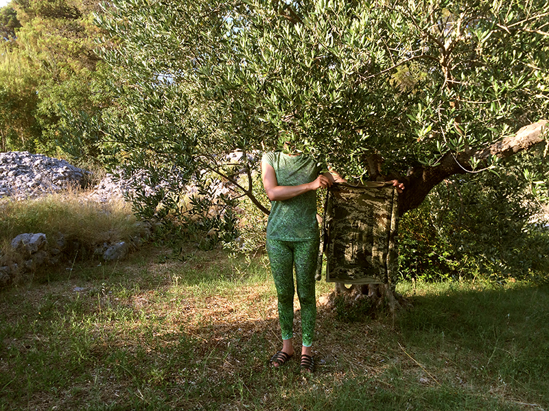
They are presenting a series of waiving T-shirt as if disembodied from the soldier that possibly once wore the exact the same shirt in combat at that very place. Now – what would a reconnaissance drone to make out of an object that is – on its own- a non-target, that is neither part of the landscape nor a human, yet a perfect hybrid that is mimicking nature and mimicking humans at the same time?
The digital manipulation of a camouflage pattern which imitates nature in the first place is also giving weight to he fact that the certainty to distinguish a genuine image from digital manipulated ones is gone. For eteam this functions as a perfect inspiration (if not justification) of attacking their own digital footage with post-production manipulation. In their video, hay bales, seen from a high up drone shot start multiplying, soldier mannequins in a Croatian army uniform shop begin to dance, and the army T-shit develops a life on its own.
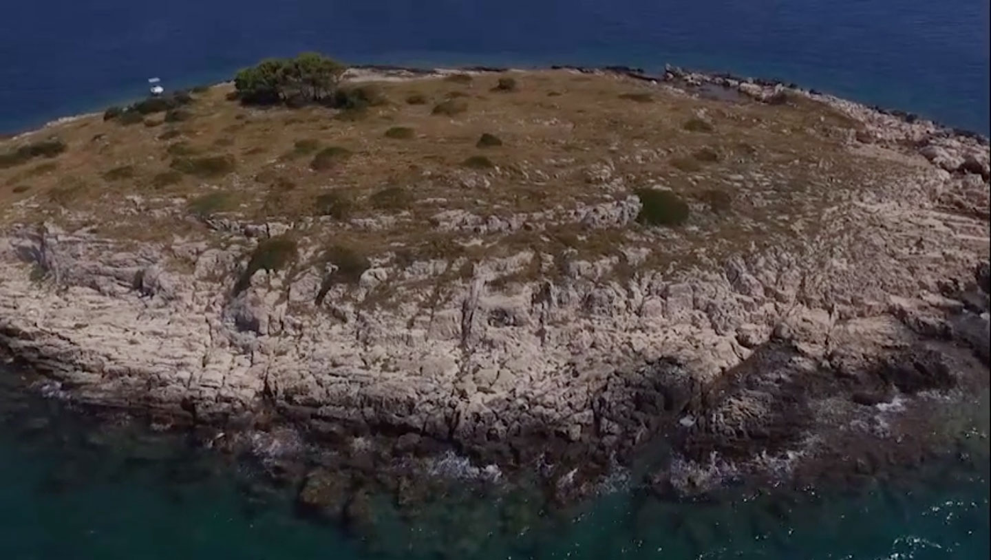
In a time where drone footage has become an over-used element in artist videos, even utilized passionately by those who vehemently criticize any form of surveillance, eteam navigates its inquiry towards more profound existential questions of this phenomenon. What is this entity seeing when face to face with a human being? Or an island? Or an human being on an island? What happens when those drones were being given a specific target (a so-called ‘waypoint’ as the video’s title includes)? While features like “waypoint” make the drone already semi-autonomous, other AI-driven behaviors allow it to cut itself completely loose from its human owner.
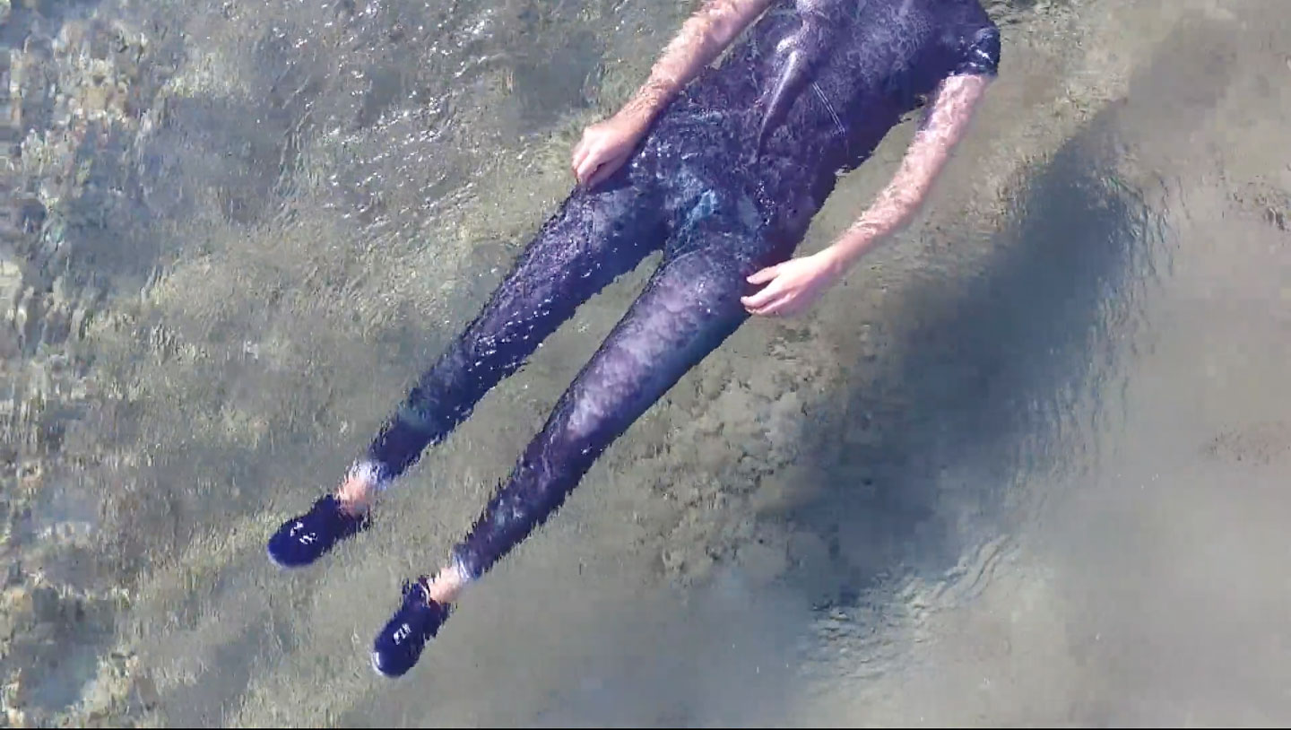
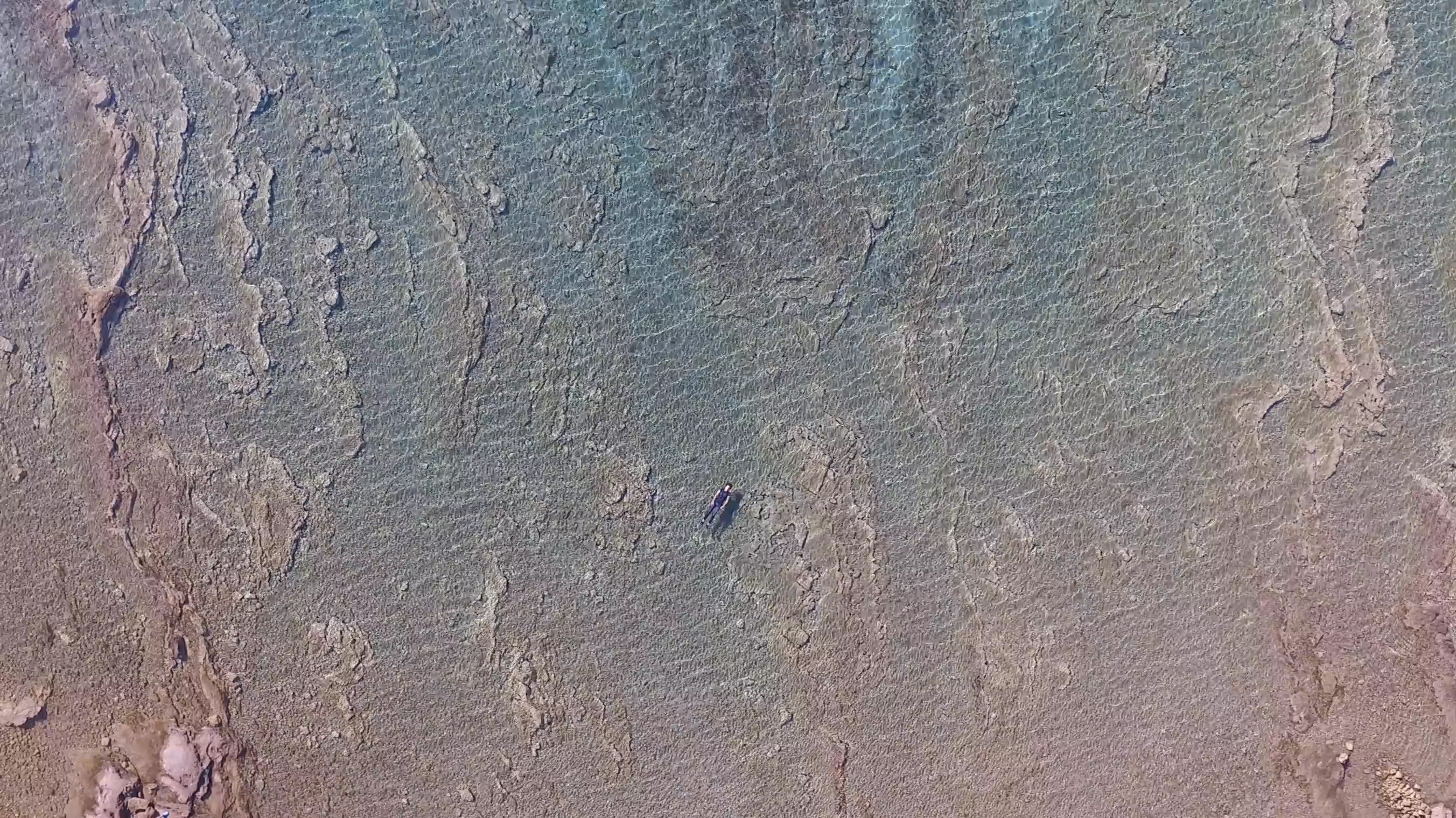
Following artists-theorists such as Teweleit, Farocki, Paglen and Steyerl into the fundamental question of what a god-like “pure” image could represent, eteam responds to this unanswerable question with a long meditation that gradually oscillates between two extreme viewpoints. A body floats in water, the drone hovers close to the body, revealing moments where its physical markup and its propulsion becomes visible in the frame by water stirred into waves. Eventually the drone starts slowly rising up into the sky into heights that let the viewer question if the drone may had already cut itself loose from ground control. Could it keep going, further ascending into the stratosphere with its own mission, no loner possible to transmit to the ground?
“Voyager” is still working.